CREATE TABLE poi_comarca_count AS
WITH poi_comarca AS (SELECT
    "ETIQUETA" AS poi,
    "TIPO_0504" AS poi_type,
    "PRIMARYIND" AS id,
    c.comarca,
    p.geom AS poi_geom,
    c.geom AS comarca_geom
FROM
    poi_castellon AS p
LEFT JOIN
    castellon_comarcas_pop_2017 AS c
    ON st_intersects(p.geom, st_transform(c.geom,25830)))
    SELECT
        comarca,
        count(*) AS count_poi,
        poi_comarca.comarca_geom
    FROM
        poi_comarca
GROUP BY comarca,poi_comarca.comarca_geom;Groupping POI by regions in PostgreSQL: Castellon’s POI by regions
Transform
PostGIS
QGIS
TYC GIS-IMFE
Exercise 3: JOINS
The exercise 3 requires to:
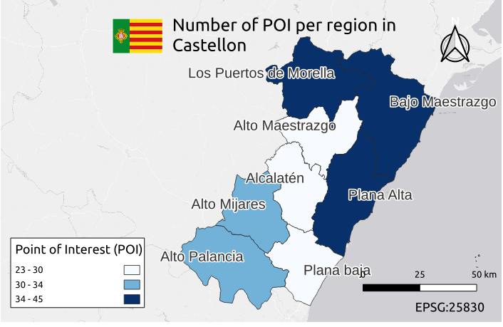
- Calculate the total number of point of interest (POI) for each region.
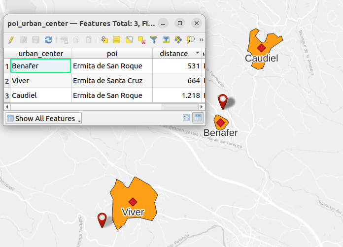
- Indicate which is the closest POI to each urban center.
Layers to be used:
- Nucleos_castellon.shp (urban centers)
- Lugares_interes_castellon.shp (POI)
- MUNICIPIOS.shp. (municipalities)
Exercise A
PostGIS
Total number of points of interest (POI) per region
Closest POI for each urban center.
CREATE TABLE poi_urban_center AS
SELECT  DISTINCT ON (urban_center)
    uc."ETIQUETA" AS urban_center,
    poi.poi,
    round(st_centroid(uc.geom)  <-> poi.poi_geom) AS distance,
    st_centroid(uc.geom) as urban_center_geom,
    poi.poi_geom AS poi_geom
FROM
     urbancenter_castellon uc
LEFT JOIN LATERAL
    (SELECT
        "ETIQUETA" AS poi,
        geom AS poi_geom
    FROM poi_castellon poi
    ORDER BY poi.geom <-> st_centroid(uc.geom)
    LIMIT 1) AS poi ON true;
QGIS
Total number of points of interest (POI) per region
Closest POI for each urban center.
Exercise B
PostGIS
Calculate the total number of bird sightings for each municipality
CREATE TABLE sigthings_municipalities AS
SELECT
    study_area.etiqueta,
    count(aves.*),
    study_area.geom
FROM
    general_postgis AS aves
JOIN
    ambito_estudio AS study_area
ON st_intersects(aves.geom, study_area.geom)
GROUP BY
    study_area.etiqueta, study_area.geom;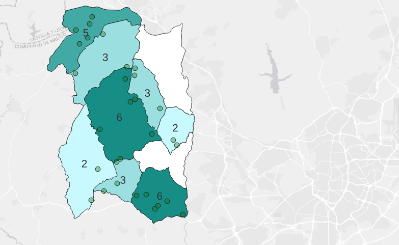
For Imfe
For this case, it is the council of the city center of Málaga which provides the data.
The layers used are:
Total number of points of interest (POI) per region
CREATE TABLE agp_city_libraries AS
SELECT
    n."NOMBARRIO" AS neighbor,
    count(l.id) AS total_library,
    n.geom AS geom_neighbor
FROM agp_city_library AS l
JOIN agp_city_neighbor AS n
    ON st_intersects(l.geom, n.geom)
GROUP BY  "NOMBARRIO", n.geom
ORDER BY total_library DESC;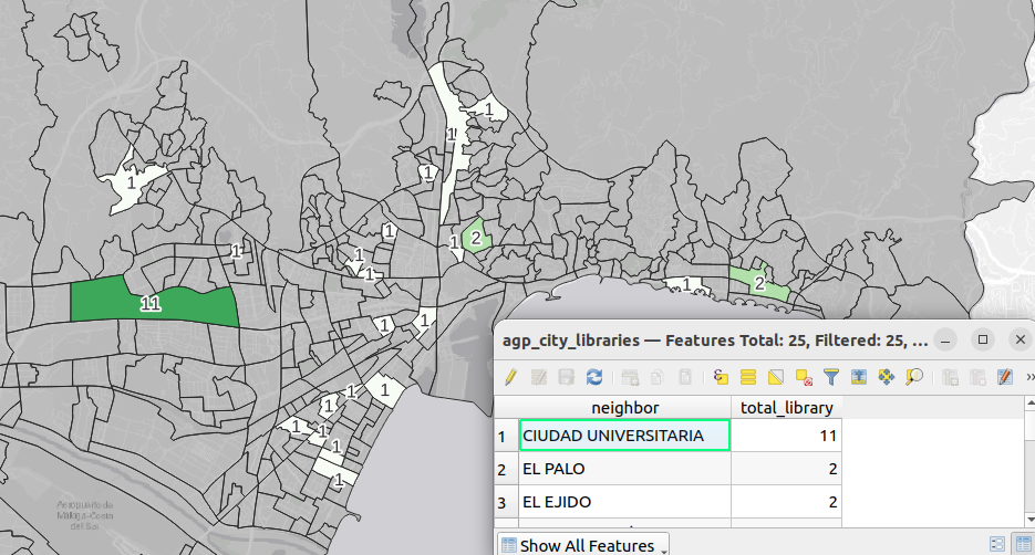
Closest POI for each urban center.
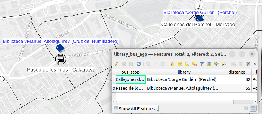
CREATE TABLE library_bus_agp AS
WITH agp_geom_bus AS
(SELECT
    *,
     st_transform(
        st_setsrid(
            st_point(lon::double precision, lat::double precision),4326),25830) AS geom
    FROM  agp_city_bus)
SELECT DISTINCT ON (l."NOMBRE")
    bs."nombreParada" AS bus_stop,
    l."NOMBRE" AS library,
    round(l.geom <-> bs.geom) AS distance,
    l.geom AS library_geom,
    bs.geom AS bus_geom
FROM agp_city_library AS l
LEFT JOIN LATERAL
(SELECT
    *
    FROM  agp_geom_bus AS b
    ORDER BY b.geom <-> l.geom
    LIMIT 1) AS bs ON true;