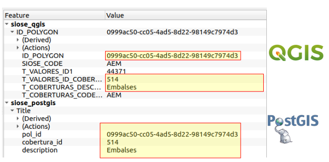
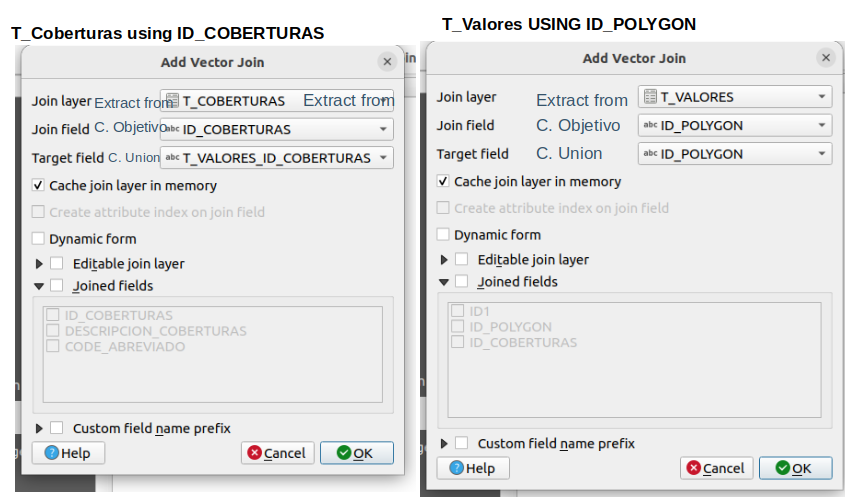
Completa la capa del SIOSE de la provincia de Castellón con la descripción del tipo de cobertura, para ello debemos relacionar la capa SIOSE_CASTELLON.shp con su leyenda. La leyenda se encuentra desglosada en 2 tablas T_VALORES y TC_SIOSE_COBERTURAS. Estudia las tablas, para establecer las relaciones necesarias entre ellas y así lograr incorporar la información de cobertura a la capa SIOSE. Nota: La capa SIOSE_CASTELLON.shp ha sido tomada en el S.C. ETRS89 UTM 30N. Finalmente representa la capa a través del campo cobertura con un tipo de simbología adecuado.
Capas a utilizar:
SIOSE_CASTELLON.shp
T_VALORES
T_COBERTURAS
PostGIS
Code
CREATE TABLE siose AS SELECT s.geom, v."ID_COBERTURAS" AS cobertura_id, c."DESCRIPCION_COBERTURAS" AS descriptionFROM siose_shape AS sJOIN siose_valores AS v ON v."ID_POLYGON"= s."ID_POLYGON"JOIN siose_coberturas AS c ON c."ID_COBERTURAS"= v."ID_COBERTURAS"
QGIS
Exercise B
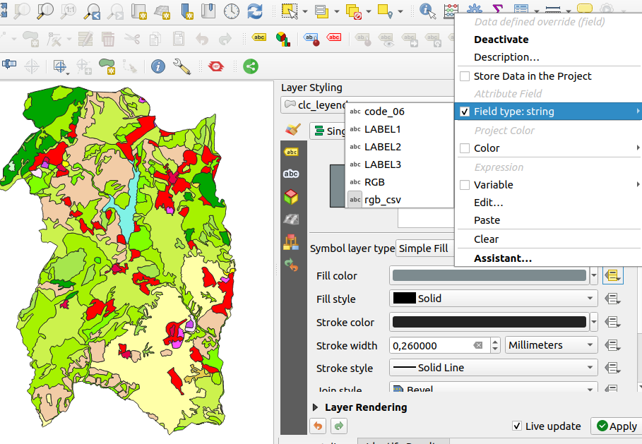
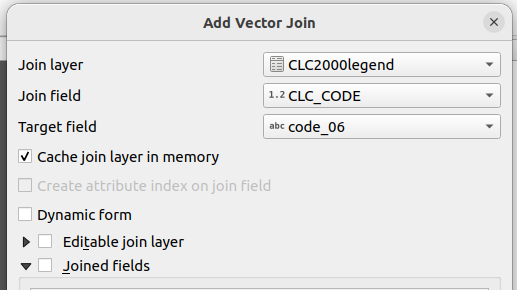
We use the tool “join” to link the Corine Land Over (CLC_ambito.shp) layer to its legend (excel spreadsheet). Name it “CLC_LEGEND.shp” to the resulting joined layer.
In spanish
cat("Utilizamos la herramienta join para relacionar la capa del Corine Land Cover (CLC_ambito.shp) con su leyenda (hoja Excel CLC2000legend.xls). Llama 'CLC_LEYEDA.shp' a la capa resultante de la unión Capas a utilizar:- CLC_ambito.shp- CLC2000legend.xls")
PostGIS
Import the data is possible using ogr2ogr or shp2pgsql. The following ogr2ogr command import the data, since it combines polygon and multipolygon, it is need to add the parameter -nln (post)
--- Explore relevant data, columns used for join & srid of the geometrySELECT pg_typeof(code_06) FROM clc_ambito; ---characterSELECT pg_typeof("CLC_CODE") FROM clc2000legend; ---integerSELECT st_srid(geom) FROM clc_ambito ; --- check srid is imported correctly automatically---- Create table CLC_LEYENDACREATETABLE CLC_LEYENDA ASSELECT*,replace(xls,"RGB", '-',',')AS RGB_csv FROM clc_ambito AS shpLEFTJOIN clc2000legend AS xlsON shp.code_06::int= xls."CLC_CODE"; --- the ::int cast the character into integer.
Note: - The column “RGB” stored the colour values and it was used replacing the “-” for “,” as this post indicated. If the RGB values were in three different columns, then this other post would have applied.
QGIS
After clicking on properties of the selected vector data “CLC_ambito_qgis” and join, the following screenshot shows the parameters required to add columns from the spreadsheet “CLC2000legend.xls”.
Importing the file malaga-en-cifras_v2.csv using dbeaver returned errors, since the string contained “..”. Using R to write the table was a workaround to import the data in the spreadsheet to the database.
For the vector data, the error “ERROR 1: Non UTF-8 content found when writing feature” is solved following this post where it explains how to use other encoding systems.
importing vector data to PostgreSQL DB using ogr2ogr
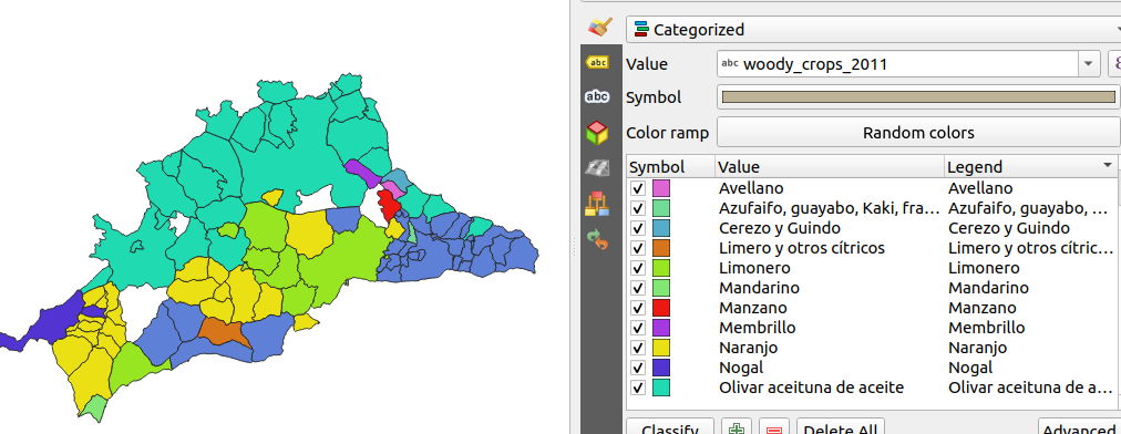
CREATETABLE muncipalities_agp_crop ASSELECT codigo AS code, shape.nombre AS muncipality, csv."Principal.cultivo.leñoso.de.regadío..2011"AS woody_crops_2011, shape.geomFROM municipalities_agp AS shapeLEFTJOIN malaga_cifras AS csvON"Id_Municipio"= codigo::integerWHERE"Principal.cultivo.leñoso.de.regadío..2011"NOTIN ('-','..');